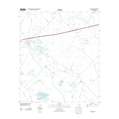
2013 Map of Alleyton
USGS Topo · Published 2013About this map
The Colorado River defines the landscape of this Colorado County region, carving a wide path past the historic settlement of Alleyton. This area is characterized by its numerous small family and community burial grounds, such as the Pinchback Obenchain Cem, Grewe Cem, and Mexican Cem, which provide significant anchor points for local genealogical research. The river valley is punctuated by distinct geographical features like Hahn Bottoms and the prominent Wilson Hill.
Find a feature on this map
64 named features on this map. Tap any name to fly to it.
Don’t see what you’re looking for? This feature index may not catch every label — zoom into the map to look around manually.
Map Details
Editions of this 2013 Alleyton Map
This is the sole edition of this map. No revisions or reprints were ever made.
Other maps of this area

1919 · Fayettsville
USGS Topo · 1:62,500

1953 · Seguin
USGS Topo · 1:250,000

1956 · Bellville
USGS Topo · 1:62,500

1956 · Glidden
USGS Topo · 1:62,500

1957 · Eagle Lake
USGS Topo · 1:62,500

1957 · Altair
USGS Topo · 1:24,000

1957 · Columbus
USGS Topo · 1:24,000

1958 · Seguin
USGS Topo · 1:250,000

1958 · Frelsburg
USGS Topo · 1:24,000

1958 · Bernardo
USGS Topo · 1:24,000