
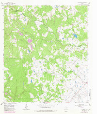
1958 Map of Bernardo
USGS Topo · Published 1959About this map
Small agricultural communities like Schmitt and Mentz anchor this rural landscape in Colorado County, where the meandering San Bernard River and Little San Bernard River define the local topography. At the southern edge of the survey, the village of Bernardo serves as a focal point for researchers, featuring the Bernardo Sch and the nearby St Rochs Ch. The map reveals a dense concentration of family cemeteries clustered in the northeast corner near the Austin Co line, including Hinsley Cem, Breitschneider Cem, and Reichardt Cem.
Find a feature on this map
31 named features on this map. Tap any name to fly to it.
Don’t see what you’re looking for? This feature index may not catch every label — zoom into the map to look around manually.
Map Details
Editions of this 1958 Bernardo Map
2 editions found
Other maps of this area

1919 · Fayettsville
USGS Topo · 1:62,500

1953 · Seguin
USGS Topo · 1:250,000

1956 · Bellville
USGS Topo · 1:62,500

1956 · Glidden
USGS Topo · 1:62,500

1957 · Eagle Lake
USGS Topo · 1:62,500

1957 · Columbus
USGS Topo · 1:24,000

1958 · Seguin
USGS Topo · 1:250,000

1958 · Industry
USGS Topo · 1:24,000

1958 · Frelsburg
USGS Topo · 1:24,000

1958 · Alleyton
USGS Topo · 1:24,000