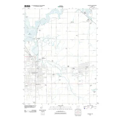
2010 Map of Alliance
USGS Topo · Published 2010About this map
Berlin Lake and the Mahoning River dominate the northern landscape of this region, which transitioned from a dense collection of small agricultural settlements like Lexington and North Benton into a significant industrial and educational hub. The presence of Mount Union and Sebring highlights the area's development along the rail-and-road corridors of Stark and Mahoning counties. Genealogists will find this particular survey especially valuable for its meticulous documentation of numerous burial grounds, ranging from the Old German Cemetery and Dutch Church Cemetery to the Quaker Hill Cemetery and Alliance Jewish Cemetery. The map also captures the local aviation infrastructure of the era, noting multiple landing strips including Barber Airport, Tri-City Airport, and the Berlin Miller Airpark Field, alongside specialized agricultural landmarks such as Stahls Orchard and Snyders Orchard.
Find a feature on this map
79 named features on this map. Tap any name to fly to it.
Don’t see what you’re looking for? This feature index may not catch every label — zoom into the map to look around manually.
Map Details
Editions of this 2010 Alliance Map
This is the sole edition of this map. No revisions or reprints were ever made.
Other maps of this area

1906 · Ravenna
USGS Topo · 1:62,500

1908 · Warren
USGS Topo · 1:62,500

1908 · Ravenna
USGS Topo · 1:62,500

1909 · Alliance
USGS Topo · 1:62,500

1909 · Lisbon
USGS Topo · 1:62,500

1950 · Cleveland
USGS Topo · 1:250,000

1951 · Canton
USGS Topo · 1:250,000

1952 · Lake Milton
USGS Topo · 1:24,000

1952 · Alliance
USGS Topo · 1:24,000

1952 · Damascus
USGS Topo · 1:24,000