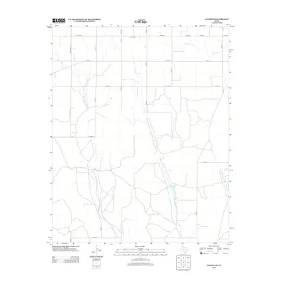
2012 Map of Allison SW
USGS Topo · Published 2012About this map
Zybach Cem sits near the northern boundary of this Wheeler County landscape, serving as a primary point of interest for those tracing family history in the Texas Panhandle. The area is defined by a dendritic drainage network where Goodin Cr and Coburn Cr flow southward through a series of section-line roads. This modern 2012 survey illustrates the distribution of water resources in a semi-arid environment, notably at Rathjen Springs and small impoundments such as Domer Reed Lake and Ed Unsen Lake. The road system, including Fm-1046 and Ranch Road 3303, follows the rigid grid typical of the region's agricultural development, connecting remote ranching properties across the plains and creek bottoms like Hackberry Cr.
Find a feature on this map
23 named features on this map. Tap any name to fly to it.
Don’t see what you’re looking for? This feature index may not catch every label — zoom into the map to look around manually.
Map Details
Editions of this 2012 Allison SW Map
This is the sole edition of this map. No revisions or reprints were ever made.
Other maps of this area

1954 · Amarillo
USGS Topo · 1:250,000

1958 · Amarillo
USGS Topo · 1:250,000

1962 · Wheeler
USGS Topo · 1:24,000

1963 · Allison
USGS Topo · 1:24,000

1963 · Kelton
USGS Topo · 1:24,000

1963 · Kelton NW
USGS Topo · 1:24,000

1963 · Briscoe
USGS Topo · 1:24,000

1963 · Allison SW
USGS Topo · 1:24,000

1967 · Dads Creek
USGS Topo · 1:24,000

1967 · Hackberry Creek
USGS Topo · 1:24,000