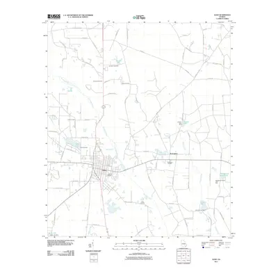
2011 Map of Alma
USGS Topo · Published 2011About this map
Alma serves as the central hub of this Georgia landscape, its grid of streets branching out into a network of agricultural lands and water-managed properties. The terrain is defined by the winding paths of Hurricane Creek and Tenmile Creek, which are punctuated by numerous man-made reservoirs including Lake Lure, Johnson Lake, and Aldridge and Eason Lake. These water bodies, often held by dams like the Johnsons Lake Dam, reflect a history of local land and water management for farming and recreation.
Find a feature on this map
80 named features on this map. Tap any name to fly to it.
Don’t see what you’re looking for? This feature index may not catch every label — zoom into the map to look around manually.
Map Details
Editions of this 2011 Alma Map
This is the sole edition of this map. No revisions or reprints were ever made.
Other maps of this area

1953 · Waycross
USGS Topo · 1:250,000

1958 · Waycross
USGS Topo · 1:250,000

1971 · Nicholls NE
USGS Topo · 1:24,000

1971 · Coffee
USGS Topo · 1:24,000

1971 · Alma NW
USGS Topo · 1:24,000

1971 · Beach
USGS Topo · 1:24,000

1971 · Alma
USGS Topo · 1:24,000

1971 · Sessoms
USGS Topo · 1:24,000

1971 · Mershon
USGS Topo · 1:24,000
1971 · Alma NE
USGS Topo · 1:24,000