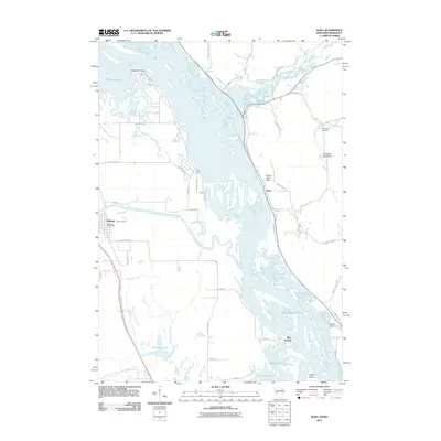
2011 Map of Alma
USGS Topo · Published 2011About this map
The Mississippi River forms a wide, complex channel system in this 2011 survey, separating the riverside communities of Alma and Kellogg. The landscape is defined by the confluence of major tributaries, including the Buffalo River and Zumbro River, which feed into the main stem amidst a network of backwaters like Robinson Lake and McCarthy Lake. This environment shaped the early development of the region, visible in the placement of the Kellogg Post Office and the riverside infrastructure at the Alma Mill 1 D6519 Dam.
Find a feature on this map
51 named features on this map. Tap any name to fly to it.
Don’t see what you’re looking for? This feature index may not catch every label — zoom into the map to look around manually.
Map Details
Editions of this 2011 Alma Map
This is the sole edition of this map. No revisions or reprints were ever made.
Other maps of this area

1932 · Cochrane
USGS Topo · 1:62,500

1932 · Wabasha
USGS Topo · 1:62,500

1932 · Alma
USGS Topo · 1:62,500

1934 · Plainview
USGS Topo · 1:62,500

1934 · Cochrane
USGS Topo · 1:62,500

1937 · Cochrane
USGS Topo · 1:62,500

1938 · Plainview
USGS Topo · 1:62,500

1950 · Alma
USGS Topo · 1:62,500

1951 · Wabasha
USGS Topo · 1:62,500

1953 · Saint Paul
USGS Topo · 1:250,000