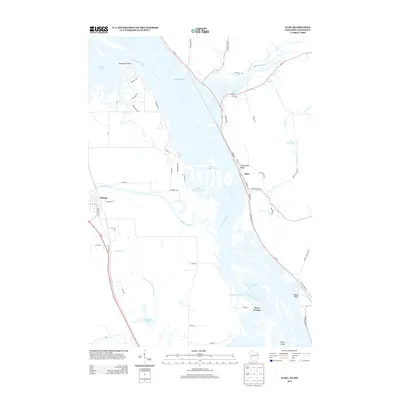
2013 Map of Alma
USGS Topo · Published 2013About this map
The Mississippi River dominates this landscape where the borders of Wisconsin and Minnesota meet, creating a complex network of islands and side channels. The settlement of Alma sits tucked against the base of Twelve Mile Bluff on the eastern bank, while across the river valley to the west, the village of Kellogg rests near the winding path of the Zumbro River. This 2013 survey illustrates the dramatic riverine geography of the Upper Mississippi, including the intricate branching of the Buffalo Slough and the wide expanses of Robinson Lake. To the south, the river braids around Fisher Island and through the West Newton Chute near the small community of West Newton. The map provides a detailed view of the valley's drainage, showing where the Buffalo River and Mill Cr contribute to the main channel.
Find a feature on this map
65 named features on this map. Tap any name to fly to it.
Don’t see what you’re looking for? This feature index may not catch every label — zoom into the map to look around manually.
Map Details
Editions of this 2013 Alma Map
This is the sole edition of this map. No revisions or reprints were ever made.
Other maps of this area

1932 · Cochrane
USGS Topo · 1:62,500

1932 · Wabasha
USGS Topo · 1:62,500

1932 · Alma
USGS Topo · 1:62,500

1934 · Plainview
USGS Topo · 1:62,500

1934 · Cochrane
USGS Topo · 1:62,500

1937 · Cochrane
USGS Topo · 1:62,500

1938 · Plainview
USGS Topo · 1:62,500

1950 · Alma
USGS Topo · 1:62,500

1951 · Wabasha
USGS Topo · 1:62,500

1953 · Saint Paul
USGS Topo · 1:250,000