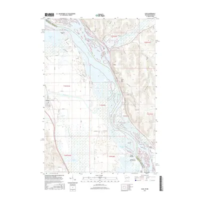
2015 Map of Alma
USGS Topo · Published 2015About this map
The Mississippi River corridor dominates this borderland survey, where the river's complex network of backwaters and side channels defines the boundary between Wisconsin and Minnesota. The settlement of Alma is perched along the eastern bank at the base of Twelve Mile Bluff, a prominent landform overlooking a maze of islands and sloughs including Buffalo Slough and Wiggle Waggle Slough. Across the water in Minnesota, the village of Kellogg sits on more level terrain near the confluence of the Zumbro River and its Old Channel Zumbro River. This 2015 data reflects a modern landscape heavily shaped by river management and conservation, evident in named features like Murphys Rock Structure and Krueger Slough. Local heritage is anchored by landmarks such as Mill Creek Cem and the small riverside community of West Newton, which sits near the northern end of Island 42.
Find a feature on this map
104 named features on this map. Tap any name to fly to it.
Don’t see what you’re looking for? This feature index may not catch every label — zoom into the map to look around manually.
Map Details
Editions of this 2015 Alma Map
This is the sole edition of this map. No revisions or reprints were ever made.
Other maps of this area

1932 · Cochrane
USGS Topo · 1:62,500

1932 · Wabasha
USGS Topo · 1:62,500

1932 · Alma
USGS Topo · 1:62,500

1934 · Plainview
USGS Topo · 1:62,500

1934 · Cochrane
USGS Topo · 1:62,500

1937 · Cochrane
USGS Topo · 1:62,500

1938 · Plainview
USGS Topo · 1:62,500

1950 · Alma
USGS Topo · 1:62,500

1951 · Wabasha
USGS Topo · 1:62,500

1953 · Saint Paul
USGS Topo · 1:250,000