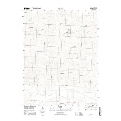
2015 Map of Alma
USGS Topo · Published 2015About this map
Alma and Concordia serve as the primary hubs in this portion of Lafayette County, where the landscape is defined by the headwaters and drainage of several key Missouri waterways. The survey highlights a rural economy centered on a network of family and community-named roads, such as Redekohr Rd, Lewis Rd, and Schoolingville Rd, reflecting generations of land ownership. Water features like Davis Creek and the S Fork Salt Fork wind through the township boundaries of T49N and T50N, shaping the placement of early settlements and travel routes.
Find a feature on this map
52 named features on this map. Tap any name to fly to it.
Don’t see what you’re looking for? This feature index may not catch every label — zoom into the map to look around manually.
Map Details
Editions of this 2015 Alma Map
This is the sole edition of this map. No revisions or reprints were ever made.
Other maps of this area

1885 · Warrensburg
USGS Topo · 1:125,000

1887 · Sedalia
USGS Topo · 1:125,000

1887 · Warrensburg
USGS Topo · 1:125,000

1889 · Lexington
USGS Topo · 1:125,000

1890 · Marshall
USGS Topo · 1:125,000

1892 · Marshall
USGS Topo · 1:125,000

1894 · Sedalia
USGS Topo · 1:125,000

1894 · Warrensburg
USGS Topo · 1:125,000

1901 · Marshall
USGS Topo · 1:125,000

1917 · Knobnoster
USGS Topo · 1:62,500