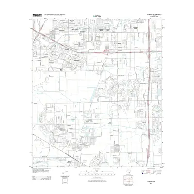
2013 Map of Almeda
USGS Topo · Published 2013About this map
Sims Bayou and Mustang Bayou define the drainage of this suburban and industrial landscape on the southern edge of the Houston metro area. The map reveals a transition from dense residential developments like Post Oak Village and Canterbury Village in the north to more scattered settlements such as Fresno and Arcola further south. This period is marked by significant infrastructure, including the Blue Ridge Oil Field and the sprawling Blue Ridge State Prison Farm. Aviation history is well-represented with both the Flyin' B Airport and Houston Southwest Airport in operation. For those researching family history, the map identifies local landmarks such as Mustang School, Beth Jacob Cem, and Fresno Cem, providing essential points of reference for the early 21st-century community.
Find a feature on this map
42 named features on this map. Tap any name to fly to it.
Don’t see what you’re looking for? This feature index may not catch every label — zoom into the map to look around manually.
Map Details
Editions of this 2013 Almeda Map
This is the sole edition of this map. No revisions or reprints were ever made.
Other maps of this area

1915 · Bellaire
USGS Topo · 1:24,000

1915 · Park Place
USGS Topo · 1:24,000

1915 · Alief
USGS Topo · 1:24,000

1920 · Mykawa
USGS Topo · 1:31,680

1920 · Almeda
USGS Topo · 1:31,680

1921 · Bellaire
USGS Topo · 1:31,680

1922 · Park Place
USGS Topo · 1:31,680

1943 · Juliff
USGS Topo · 1:31,680

1950 · Houston
USGS Topo · 1:250,000

1953 · Thompsons
USGS Topo · 1:24,000