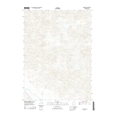
2014 Map of Almeria NE
USGS Topo · Published 2014About this map
North Loup River winds through the southwestern corner of this Nebraska landscape, defining the transition from the river valley to the complex dune formations of the Sandhills. This 2014 survey records a sparsely populated region of Loup County where the terrain is dominated by high-relief hills and depressions, including the broad Dry Valley in the southwest. Transport in this rural expanse is limited to a few documented routes such as Ne 91, while local access is provided by descriptive thoroughfares like Lonesome Pine Ave and W End Loop. The map illustrates the specialized ranching geography of the area, where the availability of water at the river's edge contrasts sharply with the arid, undulating uplands to the north and east.
Find a feature on this map
5 named features on this map. Tap any name to fly to it.
Don’t see what you’re looking for? This feature index may not catch every label — zoom into the map to look around manually.
Map Details
Editions of this 2014 Almeria NE Map
This is the sole edition of this map. No revisions or reprints were ever made.
Other maps of this area

1952 · Taylor NW
USGS Topo · 1:24,000

1952 · Almeria NE
USGS Topo · 1:24,000

1952 · Almeria NW
USGS Topo · 1:24,000

1952 · Almeria SW
USGS Topo · 1:24,000

1952 · Almeria
USGS Topo · 1:24,000

1952 · Taylor
USGS Topo · 1:24,000

1955 · Broken Bow
USGS Topo · 1:250,000

1955 · O'Neill
USGS Topo · 1:250,000

1956 · Broken Bow
USGS Topo · 1:250,000

1959 · O'Neill
USGS Topo · 1:250,000