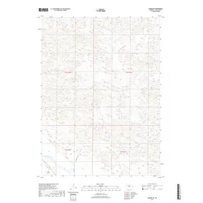
2017 Map of Almeria NE
USGS Topo · Published 2017About this map
The North Loup River winds through the southwestern corner of this Nebraska landscape, providing a vital water source in an area defined by complex sandhill topography. The terrain is marked by the presence of Dry Valley, a significant depression that illustrates the typical drainage patterns of Loup County. The human imprint on the land is sparse, characterized primarily by a grid of section lines and isolated rural roads. Names like Lonesome Pine Ave, W End Rd, and W End Loop indicate the late-twentieth-century rural infrastructure serving the remote ranching properties of the region. This 2017 data shows how modern surveying and satellite imagery record the subtle shifts in elevation and hydrology in the Nebraska Sandhills.
Find a feature on this map
9 named features on this map. Tap any name to fly to it.
Don’t see what you’re looking for? This feature index may not catch every label — zoom into the map to look around manually.
Map Details
Editions of this 2017 Almeria NE Map
This is the sole edition of this map. No revisions or reprints were ever made.
Other maps of this area

1952 · Taylor NW
USGS Topo · 1:24,000

1952 · Almeria NE
USGS Topo · 1:24,000

1952 · Almeria NW
USGS Topo · 1:24,000

1952 · Almeria SW
USGS Topo · 1:24,000

1952 · Almeria
USGS Topo · 1:24,000

1952 · Taylor
USGS Topo · 1:24,000

1955 · Broken Bow
USGS Topo · 1:250,000

1955 · O'Neill
USGS Topo · 1:250,000

1956 · Broken Bow
USGS Topo · 1:250,000

1959 · O'Neill
USGS Topo · 1:250,000