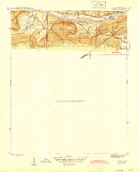
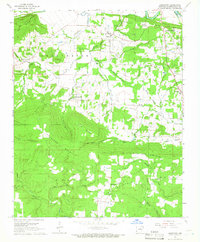
1942 Map of Almond
USGS Topo · Published 1945About this map
The White River carves a deep valley through the Ozark foothills, serving as a primary corridor for transportation and settlement in the early 1940s. Along its northern bank, the Missouri Pacific railroad follows the water's edge, passing by Foushee I and near the crossing at Earnhearts Ferry. This river-centric economy is contrasted by the high, wooded ridges of Round Mtn and Shaden Mtn that rise sharply to the south, where the local terrain dictated a more isolated lifestyle.
Find a feature on this map
18 named features on this map. Tap any name to fly to it.
Don’t see what you’re looking for? This feature index may not catch every label — zoom into the map to look around manually.
Map Details
Editions of this 1942 Almond Map
3 editions found
Other maps of this area

1890 · Batesville
USGS Topo · 1:125,000

1891 · Batesville
USGS Topo · 1:125,000
1942 · Bethesda
USGS Topo · 1:24,000
1942 · Jamestown
USGS Topo · 1:31,680
1942 · Batesville
USGS Topo · 1:31,680
1943 · Batesville
USGS Topo · 1:24,000

1953 · Memphis
USGS Topo · 1:250,000

1956 · Memphis
USGS Topo · 1:250,000
1965 · Pleasant Plains
USGS Topo · 1:24,000
1965 · Jamestown
USGS Topo · 1:24,000