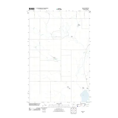
2011 Map of Aloe
USGS Topo · Published 2011About this map
Aloe stands as a small settlement in the high plains of Toole County, where the landscape is defined by an intricate network of drainage channels and small-scale water management. The terrain is deeply incised by multiple coulees, including Healy Coulee and Spring Coulee, which channel seasonal runoff through this agricultural region. The human imprint on this dry environment is most evident in its infrastructure for water storage, such as the McLean Reservoir held by the McLean Dam and the strategically placed Rocky Mountain High Dam. A grid of rural roads, many bearing family or local names like Skryja Rd, Halverson Rd, and Maggie Ward, connects the isolated farmsteads and grazing lands. In the southern reach of the sheet, Aloe Lake serves as a prominent basin where several coulees, including Rocky Springs Coulee and Potter Coulee, converge.
Find a feature on this map
23 named features on this map. Tap any name to fly to it.
Don’t see what you’re looking for? This feature index may not catch every label — zoom into the map to look around manually.
Map Details
Editions of this 2011 Aloe Map
This is the sole edition of this map. No revisions or reprints were ever made.
Other maps of this area

1909 · Cut Bank
USGS Topo · 1:125,000

1912 · Cut Bank
USGS Topo · 1:125,000

1939 · Sunburst
USGS Topo · 1:62,500

1943 · Shelby
USGS Topo · 1:62,500

1954 · Shelby
USGS Topo · 1:250,000

1958 · Shelby
USGS Topo · 1:250,000

1960 · Cut Bank
USGS Topo · 1:250,000

1963 · Cut Bank
USGS Topo · 1:250,000

1964 · Cut Bank
USGS Topo · 1:250,000
1966 · Ethridge
USGS Topo · 1:24,000