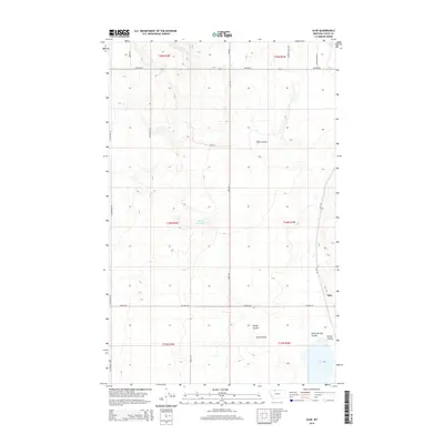
2014 Map of Aloe
USGS Topo · Published 2014About this map
Aloe stands at the eastern edge of this Toole County landscape, where the high plains are carved by a series of drainage systems. The terrain is defined by its coulees, including Healy Coulee and Spring Coulee, which channel water toward the southern reaches of the map. Significant water features like McLean Reservoir and Aloe Lake serve as critical points of reference in this arid environment, often found near the terminus of these natural drainage paths like Rocky Springs Coulee and Potter Coulee.
Find a feature on this map
31 named features on this map. Tap any name to fly to it.
Don’t see what you’re looking for? This feature index may not catch every label — zoom into the map to look around manually.
Map Details
Editions of this 2014 Aloe Map
This is the sole edition of this map. No revisions or reprints were ever made.
Other maps of this area

1909 · Cut Bank
USGS Topo · 1:125,000

1912 · Cut Bank
USGS Topo · 1:125,000

1939 · Sunburst
USGS Topo · 1:62,500

1943 · Shelby
USGS Topo · 1:62,500

1954 · Shelby
USGS Topo · 1:250,000

1958 · Shelby
USGS Topo · 1:250,000

1960 · Cut Bank
USGS Topo · 1:250,000

1963 · Cut Bank
USGS Topo · 1:250,000

1964 · Cut Bank
USGS Topo · 1:250,000
1966 · Ethridge
USGS Topo · 1:24,000