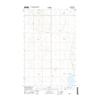
2017 Map of Aloe
USGS Topo · Published 2017About this map
Aloe stands as the primary namesake settlement in this northern Montana landscape, situated amidst a complex network of coulees and drainage systems that define the local topography. The region is marked by significant water management features, including the McLean Reservoir and Aloe Lake, which collect runoff from the surrounding prairie. A distinct pattern of rural roads and land leases, such as the Rimrock Lease, Maggie Ward, and Gillespie Rd, suggests a history of cattle ranching and agricultural development across Toole County. The drainage patterns of Healy Coulee, Sand Coulee, and Spring Coulee illustrate the natural erosion of the plains, carving out the terrain between established township boundaries and creating a rugged environment for local homesteads and transportation routes.
Find a feature on this map
32 named features on this map. Tap any name to fly to it.
Don’t see what you’re looking for? This feature index may not catch every label — zoom into the map to look around manually.
Map Details
Editions of this 2017 Aloe Map
This is the sole edition of this map. No revisions or reprints were ever made.
Other maps of this area

1909 · Cut Bank
USGS Topo · 1:125,000

1912 · Cut Bank
USGS Topo · 1:125,000

1939 · Sunburst
USGS Topo · 1:62,500

1943 · Shelby
USGS Topo · 1:62,500

1954 · Shelby
USGS Topo · 1:250,000

1958 · Shelby
USGS Topo · 1:250,000

1960 · Cut Bank
USGS Topo · 1:250,000

1963 · Cut Bank
USGS Topo · 1:250,000

1964 · Cut Bank
USGS Topo · 1:250,000
1966 · Ethridge
USGS Topo · 1:24,000