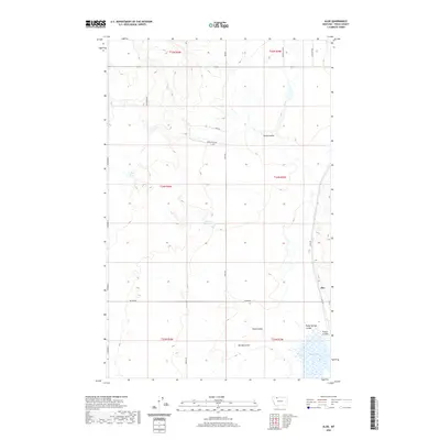
2020 Map of Aloe
USGS Topo · Published 2020About this map
Aloe stands on the eastern edge of this Toole County landscape, where the High Plains are defined by an intricate network of drainage channels and small catchments. The terrain is dominated by a series of coulees—long, narrow valleys often dry—including Healy Coulee, Sand Coulee, and the prominently named Rocky Springs Coulee. Water management is central to this environment, as evidenced by McLean Reservoir and the seasonal Aloe Lake in the southeast. A grid of local roads, many bearing family names like Halverson Rd, Skryja Rd, and Maggie Ward, traces the township and range lines. These survey-based boundaries, such as t34n r3w, partition the land into large tracts typical of Montana's ranching and dryland farming traditions. The presence of the Rimrock Lease suggests the intersection of agricultural land use with local resource management.
Find a feature on this map
25 named features on this map. Tap any name to fly to it.
Don’t see what you’re looking for? This feature index may not catch every label — zoom into the map to look around manually.
Map Details
Editions of this 2020 Aloe Map
This is the sole edition of this map. No revisions or reprints were ever made.
Other maps of this area

1909 · Cut Bank
USGS Topo · 1:125,000

1912 · Cut Bank
USGS Topo · 1:125,000

1939 · Sunburst
USGS Topo · 1:62,500

1943 · Shelby
USGS Topo · 1:62,500

1954 · Shelby
USGS Topo · 1:250,000

1958 · Shelby
USGS Topo · 1:250,000

1960 · Cut Bank
USGS Topo · 1:250,000

1963 · Cut Bank
USGS Topo · 1:250,000

1964 · Cut Bank
USGS Topo · 1:250,000
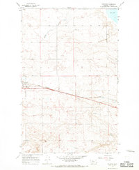
1966 · Ethridge
USGS Topo · 1:24,000