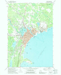
1971 Map of Alpena
USGS Topo · Published 1989About this map
Industrial activity and education define this coastal hub at the mouth of the Thunder Bay River. Extensive Quarry operations and numerous Gravel Pits north of town, connected by a dedicated Conveyor and the Detroit and Mackinac rail line, suggest an economy deeply tied to mineral extraction. The city of Alpena itself is densely mapped with institutional landmarks, including a high concentration of schools like Besser Jr High Sch and specialized facilities like the Community College.
Find a feature on this map
74 named features on this map. Tap any name to fly to it.
Don’t see what you’re looking for? This feature index may not catch every label — zoom into the map to look around manually.
Map Details
Editions of this 1971 Alpena Map
2 editions found
Other maps of this area

1954 · Tawas City
USGS Topo · 1:250,000

1954 · Alpena
USGS Topo · 1:250,000

1957 · Alpena
USGS Topo · 1:250,000

1958 · Alpena
USGS Topo · 1:250,000

1958 · Tawas City
USGS Topo · 1:250,000

1969 · Alpena
USGS Topo · 1:250,000

1971 · Lake Winyah
USGS Topo · 1:24,000

1971 · Long Lake West
USGS Topo · 1:24,000

1971 · Alpena
USGS Topo · 1:24,000

1971 · Middle Island
USGS Topo · 1:24,000