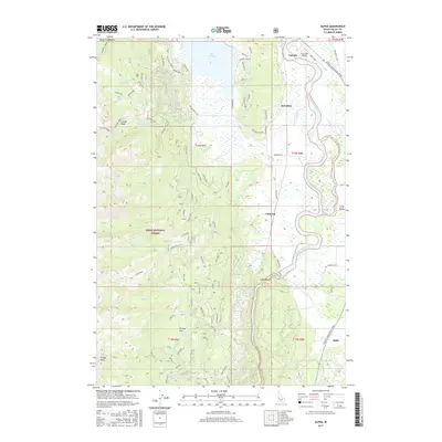
2017 Map of Alpha
USGS Topo · Published 2017About this map
The North Fork Payette River winds through the eastern portion of this Idaho landscape, anchoring the valley floor where the settlements of Cascade, Belvidere, Cabarton, and Alpha are established. This 2017 survey details the diverse geography of Long Valley, transitioning from the wetlands and shoreline of Lake Cascade to the elevated reaches of the Boise National Forest. High-altitude landmarks like Tripod Peak, Collier Peak, and W Mountain overlook the drainage basins of Brush Cr and Moores Cr.
Find a feature on this map
41 named features on this map. Tap any name to fly to it.
Don’t see what you’re looking for? This feature index may not catch every label — zoom into the map to look around manually.
Map Details
Editions of this 2017 Alpha Map
This is the sole edition of this map. No revisions or reprints were ever made.
Other maps of this area

1894 · Squaw Creek
USGS Topo · 1:125,000

1909 · Garden Valley
USGS Topo · 1:125,000

1911 · Meadows
USGS Topo · 1:125,000

1953 · Smiths Ferry
USGS Topo · 1:62,500

1953 · Boiling Springs
USGS Topo · 1:62,500

1954 · Gold Fork
USGS Topo · 1:62,500

1954 · Cascade
USGS Topo · 1:62,500

1955 · Baker
USGS Topo · 1:250,000

1957 · Challis
USGS Topo · 1:250,000

1959 · Baker
USGS Topo · 1:250,000