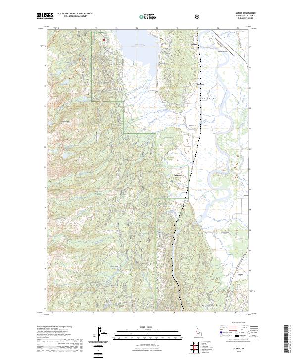
2024 Map of Alpha
USGS Topo · Published 2024About this map
Long Valley serves as the central corridor for this mountain landscape, where the North Fork Payette River winds through a mixture of meadows and timberland within the Boise National Forest. The northern extent of the map is dominated by the waters of Lake Cascade, which sits adjacent to the town of Cascade and its Cascade Airport. The terrain shifts dramatically to the west as the floor rises toward the West Mountains and peaks like Collier Peak. Local infrastructure and settlement patterns are evident in the small communities of Belvidere, Cabarton, and Alpha, connected by the Payette River Scenic Byway and a network of timber and access routes such as Mine Road and Maint Shed. This map documents a region where recreational lakefronts and river valleys meet the industrial and conservation history of the Idaho backcountry.
Find a feature on this map
69 named features on this map. Tap any name to fly to it.
Don’t see what you’re looking for? This feature index may not catch every label — zoom into the map to look around manually.
Map Details
Editions of this 2024 Alpha Map
This is the sole edition of this map. No revisions or reprints were ever made.
Other maps of this area

1894 · Squaw Creek
USGS Topo · 1:125,000

1909 · Garden Valley
USGS Topo · 1:125,000

1911 · Meadows
USGS Topo · 1:125,000

1953 · Smiths Ferry
USGS Topo · 1:62,500

1953 · Boiling Springs
USGS Topo · 1:62,500

1954 · Gold Fork
USGS Topo · 1:62,500

1954 · Cascade
USGS Topo · 1:62,500

1955 · Baker
USGS Topo · 1:250,000

1957 · Challis
USGS Topo · 1:250,000

1959 · Baker
USGS Topo · 1:250,000