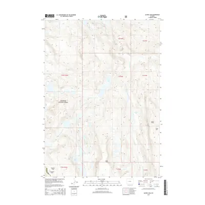
2015 Map of Alpine Lake
USGS Topo · Published 2015About this map
Alpine Lake sits at the heart of this high-elevation landscape within the Shoshone National Forest, where the hydrology is defined by the headwaters of the Bull Lake Creek system. The map documents a complex network of alpine drainages, including N Fork Bull Lake Cr, S Fork Bull Lake Cr, and Middle Fork Bull Lake Cr, which carve through the high country. In the southwestern corner, the Continental Divide traces along the Wind River Range, marking the fundamental hydrologic boundary of the American West. The terrain is characterized by prominent high-altitude landmarks such as Windy Peak and Milky Ridge, alongside isolated water bodies like Deadman Lake and the Milky Lakes. This map provides a detailed view of the high-country topography at the intersection of Fremont and Sublette counties before any significant modern development altered these remote drainages.
Find a feature on this map
23 named features on this map. Tap any name to fly to it.
Don’t see what you’re looking for? This feature index may not catch every label — zoom into the map to look around manually.
Map Details
Editions of this 2015 Alpine Lake Map
This is the sole edition of this map. No revisions or reprints were ever made.
Other maps of this area

1909 · Fremont Peak
USGS Topo · 1:125,000

1938 · Mt Bonneville
USGS Topo · 1:62,500

1941 · Mt Bonneville
USGS Topo · 1:62,500

1942 · Mt Bonneville
USGS Topo · 1:62,500

1952 · Bob Lakes
USGS Topo · 1:24,000

1952 · Kirkland Park
USGS Topo · 1:24,000

1952 · Paradise Basin
USGS Topo · 1:24,000

1952 · Alpine Lake
USGS Topo · 1:24,000

1955 · Thermopolis
USGS Topo · 1:250,000

1955 · Lander
USGS Topo · 1:250,000