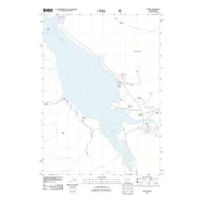
2011 Map of Alpine
USGS Topo · Published 2011About this map
Palisades Reservoir dominates this landscape on the Wyoming-Idaho border, where the Salt River meets the expansive waters of Grand Valley. The 2011 survey documents a region defined by outdoor recreation and transportation, anchored by the settlements of Alpine and Alpine Junction. The map illustrates the convergence of several mountain canyons, including Grand Canyon and Jordan Canyon, which funnel towards the reservoir's edge.
Find a feature on this map
34 named features on this map. Tap any name to fly to it.
Don’t see what you’re looking for? This feature index may not catch every label — zoom into the map to look around manually.
Map Details
Editions of this 2011 Alpine Map
This is the sole edition of this map. No revisions or reprints were ever made.
Other maps of this area

1931 · Jackson
USGS Topo · 1:125,000

1932 · Irwin
USGS Topo · 1:96,000

1935 · Irwin
USGS Topo · 1:125,000

1935 · Jackson
USGS Topo · 1:125,000

1955 · Driggs
USGS Topo · 1:250,000

1958 · Driggs
USGS Topo · 1:250,000

1962 · Driggs
USGS Topo · 1:250,000

1963 · Observation Peak
USGS Topo · 1:24,000

1963 · Ferry Peak
USGS Topo · 1:24,000
1965 · Stewart Peak
USGS Topo · 1:24,000