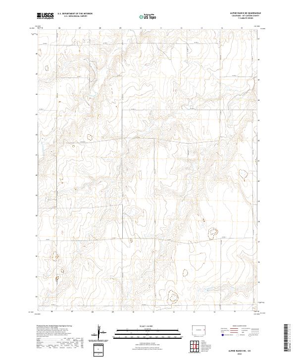
2022 Map of Alpine Ranch NE
USGS Topo · Published 2022About this map
Landsman Cr and Sand Creek wind through this high plains landscape in Kit Carson County, following the natural drainage patterns of eastern Colorado. This modern topographic study reveals a strictly organized grid of county roads, such as Co Rd 30 and Co Rd 34, that define the agricultural and ranching boundaries of the region. The map detail highlights the sparse, resilient nature of life on the plains, where watercourses like Sand Cr serve as the primary geographical landmarks against the expansive township and range system. While primarily rural, the network of routes including Co Rd J and Co Rd R provides a clear view of the transportation infrastructure that supports the local ranching community, showing how land use is dictated by both the section lines and the subtle variations in elevation along the creek beds.
Find a feature on this map
25 named features on this map. Tap any name to fly to it.
Don’t see what you’re looking for? This feature index may not catch every label — zoom into the map to look around manually.
Map Details
Editions of this 2022 Alpine Ranch NE Map
This is the sole edition of this map. No revisions or reprints were ever made.
Other maps of this area

1954 · Limon
USGS Topo · 1:250,000

1957 · Limon
USGS Topo · 1:250,000

1958 · Limon
USGS Topo · 1:250,000

1969 · Alpine Ranch NE
USGS Topo · 1:24,000

1969 · Bethune
USGS Topo · 1:24,000

1969 · Burlington 3 NW
USGS Topo · 1:24,000

1969 · Stratton
USGS Topo · 1:24,000

1969 · Alpine Ranch
USGS Topo · 1:24,000
1969 · Burlington 3 SW
USGS Topo · 1:24,000
1970 · South of Bethune
USGS Topo · 1:24,000