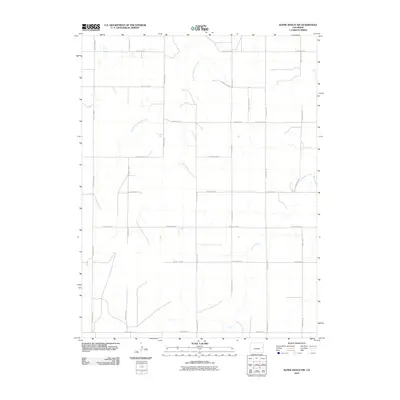
2010 Map of Alpine Ranch NW
USGS Topo · Published 2010About this map
Landsman Creek and the East Branch Spring Creek carve subtle drainage patterns across this high plains landscape in Kit Carson County. The area is defined by a rigid section-line grid of rural routes, including County Road R at the northern boundary and County Road G to the south. This systematic road network reflects the enduring homesteading legacy of eastern Colorado, where transportation is dictated by the cardinal directions of the Public Land Survey System. Apart from these ephemeral waterways and a primary corridor along County Hwy 23, the map reveals a sparsely populated agricultural environment focused on dryland farming or ranching. The presence of numerous small stock tanks and cattle guards near roads like County Road P underscores the region's reliance on groundwater management in an arid climate.
Find a feature on this map
18 named features on this map. Tap any name to fly to it.
Don’t see what you’re looking for? This feature index may not catch every label — zoom into the map to look around manually.
Map Details
Editions of this 2010 Alpine Ranch NW Map
This is the sole edition of this map. No revisions or reprints were ever made.
Other maps of this area

1954 · Limon
USGS Topo · 1:250,000

1957 · Limon
USGS Topo · 1:250,000

1958 · Limon
USGS Topo · 1:250,000

1969 · Alpine Ranch NE
USGS Topo · 1:24,000

1969 · Stratton
USGS Topo · 1:24,000

1969 · Alpine Ranch
USGS Topo · 1:24,000

1979 · Stratton 3 SE
USGS Topo · 1:24,000

1979 · Vona
USGS Topo · 1:24,000
1979 · Alpine Ranch NW
USGS Topo · 1:24,000

1979 · Stratton 3 NE
USGS Topo · 1:24,000