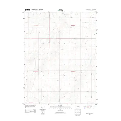
2013 Map of Alpine Ranch NW
USGS Topo · Published 2013About this map
Landsman Cr and E Br Spring Cr carve subtle drainages across this high plains landscape in eastern Colorado, defining the natural topography of Kit Carson County. The map reveals a strictly regulated agrarian landscape structured by the Public Land Survey System, with township and range lines like t010s r047w dictating the placement of the human infrastructure. This grid is mirrored in the expansive network of section-line roads, including Co Road 24 and Co Road R, which provide the primary access to this sparsely settled ranching territory. The absence of named towns emphasizes the rural character of the area, where water sources and the surveyed grid remain the most significant landmarks for local land use and boundary identification.
Find a feature on this map
24 named features on this map. Tap any name to fly to it.
Don’t see what you’re looking for? This feature index may not catch every label — zoom into the map to look around manually.
Map Details
Editions of this 2013 Alpine Ranch NW Map
This is the sole edition of this map. No revisions or reprints were ever made.
Other maps of this area

1954 · Limon
USGS Topo · 1:250,000

1957 · Limon
USGS Topo · 1:250,000

1958 · Limon
USGS Topo · 1:250,000

1969 · Alpine Ranch NE
USGS Topo · 1:24,000

1969 · Stratton
USGS Topo · 1:24,000

1969 · Alpine Ranch
USGS Topo · 1:24,000

1979 · Stratton 3 SE
USGS Topo · 1:24,000

1979 · Vona
USGS Topo · 1:24,000
1979 · Alpine Ranch NW
USGS Topo · 1:24,000

1979 · Stratton 3 NE
USGS Topo · 1:24,000