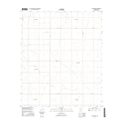
2017 Map of Alston Ranch
USGS Topo · Published 2017About this map
Alston Ranch serves as the central namesake for this high plains landscape in eastern New Mexico. The terrain is defined by a sparse network of county roads and family-named thoroughfares that trace the boundaries of township and range divisions within the southern High Plains. Notable north-south corridors like Simonola Valley Rd and Co Rd 149 intersect with east-west routes such as Sartin Rd and W McDonald Rd, revealing a land use pattern dominated by large-scale ranching and agriculture. The presence of specialized roads like Lonesome Dove and High Top Rd provides insight into the local nomenclature of the region. This 2017 survey by the U.S. Geological Survey documents the exact legal and topographic framework of the area, from the precise placement of ranch access points to the detailed elevation contours of the Llano Estacado.
Find a feature on this map
18 named features on this map. Tap any name to fly to it.
Don’t see what you’re looking for? This feature index may not catch every label — zoom into the map to look around manually.
Map Details
Editions of this 2017 Alston Ranch Map
This is the sole edition of this map. No revisions or reprints were ever made.
Other maps of this area

1954 · Brownfield
USGS Topo · 1:250,000

1958 · Brownfield
USGS Topo · 1:250,000

1962 · Brownfield
USGS Topo · 1:250,000

1970 · Simanola Valley
USGS Topo · 1:24,000

1970 · Hillburn City
USGS Topo · 1:24,000

1970 · Tatum South
USGS Topo · 1:24,000

1970 · Alston Ranch
USGS Topo · 1:24,000

1970 · Tatum North
USGS Topo · 1:24,000

1970 · Hillburn City SW
USGS Topo · 1:24,000

1973 · Fort Ranch
USGS Topo · 1:24,000