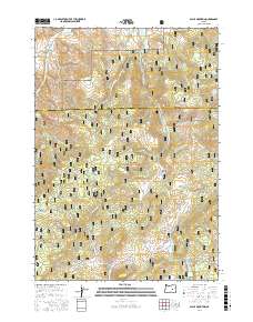
2017 Map of Alsup Mountain
USGS Topo · Published 2017About this map
The Malheur National Forest dominates this section of the Oregon high country, where the boundary between Grant and Harney counties crosses a landscape of timbered ridges and volcanic peaks. Notable elevations like Alsup Mountain and Donovan Mtn rise above a series of high-altitude meadows and flats, including Sunflower Flat and Sawtooth Meadows. Water management is central to this environment, evidenced by numerous small catchments such as Rickman Reservoir, Browns Reservoir, and Crystal Reservoir. The S Fork John Day River and its many tributaries, including Corral Cr and Bear Cr, drain the terrain, which is primarily navigated via a network of forest development roads like the Burns-Izee Rd and the Izee-Officer Ranch Rd. The presence of many named springs, such as Chris Borg Spring and Devils Garden Spring, highlights the importance of reliable water sources in this dry mountain region.
Find a feature on this map
64 named features on this map. Tap any name to fly to it.
Don’t see what you’re looking for? This feature index may not catch every label — zoom into the map to look around manually.
Map Details
Editions of this 2017 Alsup Mountain Map
This is the sole edition of this map. No revisions or reprints were ever made.
Other maps of this area

1955 · Burns
USGS Topo · 1:250,000

1955 · Canyon City
USGS Topo · 1:250,000

1958 · Burns
USGS Topo · 1:250,000

1959 · Burns
USGS Topo · 1:250,000

1959 · Canyon City
USGS Topo · 1:250,000

1959 · West Myrtle Butte
USGS Topo · 1:62,500

1959 · Sawtooth Creek
USGS Topo · 1:62,500

1961 · Logdell
USGS Topo · 1:62,500

1961 · Izee
USGS Topo · 1:62,500

1981 · Dayville
USGS Topo · 1:100,000