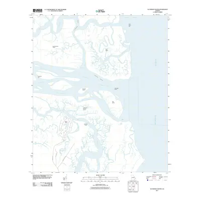
2011 Map of Altamaha Sound
USGS Topo · Published 2011About this map
Altamaha Sound and the surrounding labyrinth of tidal marshes define this coastal landscape where the Altamaha River meets the Atlantic Ocean. The area is characterized by a complex network of waterways, including the Intracoastal Waterway, Hampton River, and the South Altamaha River, which separate numerous barrier islands and interior hammocks. On the southern edge of the sound, Little Saint Simons Island and Egg Island sit across from Wolf Island, which is bordered by Doboy Sound to the north.
Find a feature on this map
32 named features on this map. Tap any name to fly to it.
Don’t see what you’re looking for? This feature index may not catch every label — zoom into the map to look around manually.
Map Details
Editions of this 2011 Altamaha Sound Map
This is the sole edition of this map. No revisions or reprints were ever made.
Other maps of this area

1920 · Cabretta Island
USGS Topo · 1:62,500

1921 · Darien
USGS Topo · 1:62,500

1944 · Cabretta Island
USGS Topo · 1:62,500

1945 · Brunswick
USGS Topo · 1:62,500

1946 · Brunswick
USGS Topo · 1:250,000

1948 · Brunswick
USGS Topo · 1:250,000

1954 · Altamaha Sound
USGS Topo · 1:24,000
1954 · Doboy Sound
USGS Topo · 1:24,000
1954 · Ridgeville
USGS Topo · 1:24,000

1954 · Cabretta Inlet
USGS Topo · 1:24,000