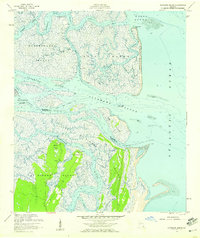
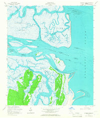
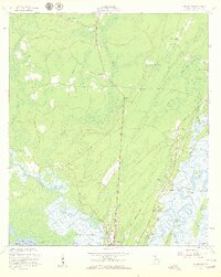
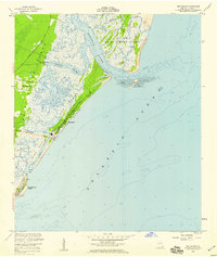
1954 Map of Altamaha Sound
USGS Topo · Published 1959About this map
St Simons Island and its northern coastal reaches are defined by a complex network of salt marshes and tidal estuaries where the Altamaha River meets the Atlantic Ocean. This 1950s survey captures the area before modern development reached these outer points, highlighting established locations like Butler Point and Cannons Point on the northern tip of St. Simons. The map illustrates the critical maritime path of the Intracoastal Waterway as it threads through Buttermilk Sound and Altamaha Sound. To the north, the protected landscape of the Wolf Island National Wildlife Refuge encompasses Wolf Island and the Wolf Island Spit, preserving a wilderness of tidal flats and winding creeks such as Beacon Creek and Beach Creek. This era of mapping shows numerous Artesian Wells scattered across the island hammocks, indicating early groundwater reliance for these remote coastal outposts.
Find a feature on this map
36 named features on this map. Tap any name to fly to it.
Don’t see what you’re looking for? This feature index may not catch every label — zoom into the map to look around manually.
Map Details
Editions of this 1954 Altamaha Sound Map
2 editions found
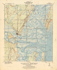
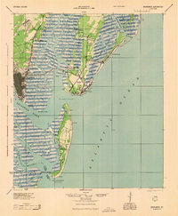
Other maps of this area

1920 · Cabretta Island
USGS Topo · 1:62,500
1921 · Darien
USGS Topo · 1:62,500

1944 · Cabretta Island
USGS Topo · 1:62,500
1945 · Brunswick
USGS Topo · 1:62,500

1946 · Brunswick
USGS Topo · 1:250,000

1948 · Brunswick
USGS Topo · 1:250,000

1954 · Doboy Sound
USGS Topo · 1:24,000
1954 · Ridgeville
USGS Topo · 1:24,000

1954 · Cabretta Inlet
USGS Topo · 1:24,000
1955 · Sea Island
USGS Topo · 1:24,000