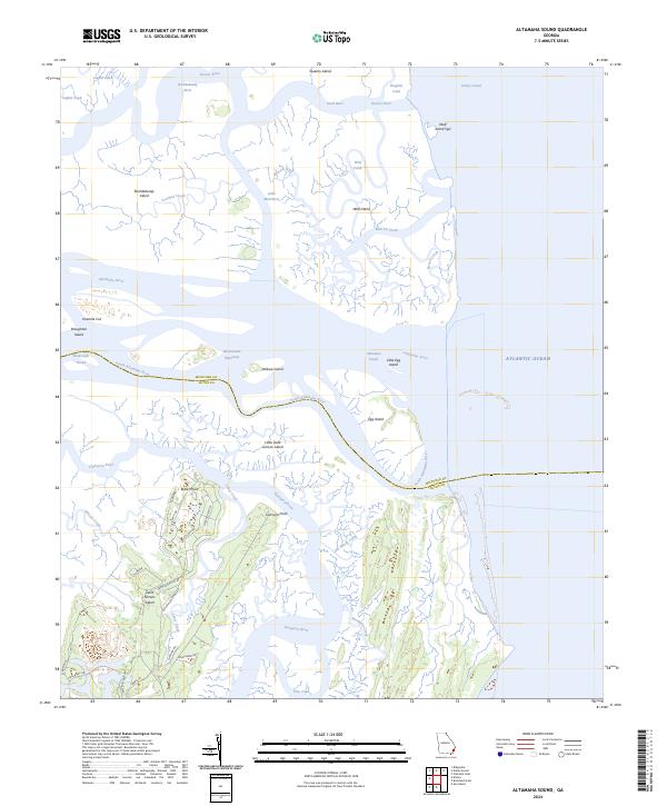
2024 Map of Altamaha Sound
USGS Topo · Published 2024About this map
Wolf Island National Wildlife Refuge and the surrounding Wolf Island Wilderness dominate this coastal Georgia landscape where the Altamaha River meets the Atlantic Ocean. The map reveals a complex network of barrier islands and tidal waterways, including the Darien River and Doboy Sound, highlighting the delicate transition between freshwater outflows and the sea. On the southern portion of the map, the northern tip of Saint Simons Island shows a grid of historical thoroughfares such as Butler Plantation Rd and Pikes Bluff Dr, reaching toward Butler Point. The inclusion of the Intracoastal Waterway cutting through Buttermilk Sound underscores the area's significance for maritime navigation. Land-use patterns here are defined by conservation and historical plantation tracts, with names like Cannons Point and Little Saint Simons Island marking the edge of the Georgia coast's inhabited reaches.
Find a feature on this map
49 named features on this map. Tap any name to fly to it.
Don’t see what you’re looking for? This feature index may not catch every label — zoom into the map to look around manually.
Map Details
Editions of this 2024 Altamaha Sound Map
This is the sole edition of this map. No revisions or reprints were ever made.
Other maps of this area

1920 · Cabretta Island
USGS Topo · 1:62,500

1921 · Darien
USGS Topo · 1:62,500

1944 · Cabretta Island
USGS Topo · 1:62,500

1945 · Brunswick
USGS Topo · 1:62,500

1946 · Brunswick
USGS Topo · 1:250,000

1948 · Brunswick
USGS Topo · 1:250,000

1954 · Altamaha Sound
USGS Topo · 1:24,000
1954 · Doboy Sound
USGS Topo · 1:24,000
1954 · Ridgeville
USGS Topo · 1:24,000

1954 · Cabretta Inlet
USGS Topo · 1:24,000