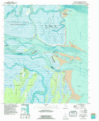
1993 Map of Altamaha Sound
USGS Topo · Published 1995About this map
Hampton Plantation and Cannons Point sit at the northern edge of the Georgia coastal islands, where the Altamaha River system meets the Atlantic Ocean. This mid-1990s record details a complex estuarine environment defined by shifting sands and protected wetlands, including the Wolf Island National Wildlife Refuge and Wilderness Area and the Altamaha State Waterfowl Management Area. Navigation remains central to the landscape, with the Intracoastal Waterway threading through Buttermilk Sound and past Broughton Island. Local history is visible in the ruins near the tip of St Simons Island and the established route of Lawrence Road, while the bathymetric data provides a rare look at the underwater topography of Altamaha Sound and its various channels like One Mile Cut and the Hampton River.
Find a feature on this map
39 named features on this map. Tap any name to fly to it.
Don’t see what you’re looking for? This feature index may not catch every label — zoom into the map to look around manually.
Map Details
Editions of this 1993 Altamaha Sound Map
This is the sole edition of this map. No revisions or reprints were ever made.
Other maps of this area

1920 · Cabretta Island
USGS Topo · 1:62,500

1921 · Darien
USGS Topo · 1:62,500

1944 · Cabretta Island
USGS Topo · 1:62,500

1945 · Brunswick
USGS Topo · 1:62,500

1946 · Brunswick
USGS Topo · 1:250,000

1948 · Brunswick
USGS Topo · 1:250,000

1954 · Altamaha Sound
USGS Topo · 1:24,000
1954 · Doboy Sound
USGS Topo · 1:24,000
1954 · Ridgeville
USGS Topo · 1:24,000

1954 · Cabretta Inlet
USGS Topo · 1:24,000