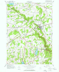
1944 Map of Altamont
USGS Topo · Published 1977About this map
The Helderberg Mountains define the dramatic topography of this 1944 survey, where the steep escarpment of the Thacher State Park meets the lowlands of the Delaware and Hudson railroad corridor. The village of Altamont serves as a central hub, featuring the Fairgrounds, Lasalette Seminary, and the Union Sch. The landscape is dotted with small rural schoolhouses, including Settles Hill Sch and School No 2, reflecting an era of localized education before district consolidation. Water resources are prominent throughout the area, from the Altamont Reservoir to the recreational waters of Thompsons Lake and Warner Lake in the southern portion. Local genealogy is well-preserved through numerous family burial sites such as Ostrander Cem, Snyder Cem, and Severson Cem, which mark the early settlement patterns of Albany and Schenectady counties.
Find a feature on this map
52 named features on this map. Tap any name to fly to it.
Don’t see what you’re looking for? This feature index may not catch every label — zoom into the map to look around manually.
Map Details
Editions of this 1944 Altamont Map
4 editions found
Other maps of this area

1893 · Schenectady
USGS Topo · 1:62,500

1893 · Albany
USGS Topo · 1:62,500

1895 · Albany
USGS Topo · 1:62,500

1895 · Schenectady
USGS Topo · 1:62,500

1895 · Amsterdam
USGS Topo · 1:62,500

1898 · Schenectady
USGS Topo · 1:62,500

1898 · Albany
USGS Topo · 1:62,500

1900 · Berne
USGS Topo · 1:62,500

1903 · Berne
USGS Topo · 1:62,500

1927 · Albany
USGS Topo · 1:62,500