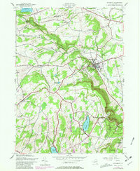
1944 Map of Altamont
USGS Topo · Published 1981About this map
Altamont sits at the foot of the Helderberg Mountains, where the Delaware and Hudson railroad tracks pass through the village on their way toward the Mohawk Valley. This 1944 survey captures the dramatic transition from the valley floor to the limestone cliffs of Indian Ladder and the John Boyd Thacher State Park. The plateau above the escarpment is a mix of small agricultural settlements like Knox and recreational areas surrounding Thompsons Lake. Evidence of early community life is scattered throughout the hills, from the Lasalette Seminary near the village to rural landmarks such as the Settles Hill Sch and Ostrander Cem. The landscape is deeply carved by waterways including the Bozen Kill, which features the notable Bozen Kill Falls in the northwestern corner of the quadrangle.
Find a feature on this map
50 named features on this map. Tap any name to fly to it.
Don’t see what you’re looking for? This feature index may not catch every label — zoom into the map to look around manually.
Map Details
Editions of this 1944 Altamont Map
4 editions found
Other maps of this area

1893 · Schenectady
USGS Topo · 1:62,500

1893 · Albany
USGS Topo · 1:62,500

1895 · Albany
USGS Topo · 1:62,500

1895 · Schenectady
USGS Topo · 1:62,500

1895 · Amsterdam
USGS Topo · 1:62,500

1898 · Schenectady
USGS Topo · 1:62,500

1898 · Albany
USGS Topo · 1:62,500

1900 · Berne
USGS Topo · 1:62,500

1903 · Berne
USGS Topo · 1:62,500

1927 · Albany
USGS Topo · 1:62,500