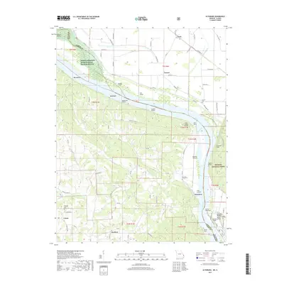
2017 Map of Altenburg
USGS Topo · Published 2017About this map
The Mississippi River carves a dramatic boundary through this region, where the steep bluffs of the Shawnee National Forest in Illinois meet the historic German Lutheran settlements of Perry County, Missouri. The landscape is defined by its proximity to the water, from the sprawling bottomlands of the Middle Mississippi River National Wildlife Refuge to the geological landmarks of Devils Bake Oven and Tower Rock. Historically significant communities like Altenburg, Frohna, and Wittenberg are documented with their traditional street layouts and local landmarks, including Saint Pauls Lutheran Cem and Concordia Lutheran Cem. This area demonstrates a complex relationship between human habitation and the river's floodplain, seen in the extensive network of Levee Rd and the protected habitats of Wilkinson Island and Lacours Island.
Find a feature on this map
84 named features on this map. Tap any name to fly to it.
Don’t see what you’re looking for? This feature index may not catch every label — zoom into the map to look around manually.
Map Details
Editions of this 2017 Altenburg Map
This is the sole edition of this map. No revisions or reprints were ever made.
Other maps of this area

1910 · Murphysboro
USGS Topo · 1:62,500

1916 · Campbell Hill
USGS Topo · 1:62,500

1918 · Altenburg
USGS Topo · 1:62,500

1918 · Campbell Hill
USGS Topo · 1:62,500

1924 · Alto Pass
USGS Topo · 1:62,500

1925 · Altenburg
USGS Topo · 1:62,500

1938 · Murphysboro
USGS Topo · 1:62,500

1947 · Alto Pass
USGS Topo · 1:62,500

1947 · Crosstown
USGS Topo · 1:24,000

1947 · Oak Ridge
USGS Topo · 1:24,000