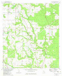
1982 Map of Altha East
USGS Topo · Published 1982About this map
Alliance and Macedonia anchor this rural landscape in the early 1980s, where the border between Jackson Co and Calhoun Co marks a terrain defined by complex water drainage. The area is heavily intersected by small watercourses such as Thomas Mill Creek, Wilson Mill Creek, and Flowers Creek, which feed into the larger Chipola Creek system. This network supported local industry and transport, evidenced by landmarks like Henderson Mill and the McCroan Airstrip.
Find a feature on this map
30 named features on this map. Tap any name to fly to it.
Don’t see what you’re looking for? This feature index may not catch every label — zoom into the map to look around manually.
Map Details
Editions of this 1982 Altha East Map
This is the sole edition of this map. No revisions or reprints were ever made.
Other maps of this area

1944 · Clarksville
USGS Topo · 1:31,680

1945 · Blountstown
USGS Topo · 1:31,680

1945 · Clarksville
USGS Topo · 1:31,680

1945 · Bristol
USGS Topo · 1:31,680

1952 · Cypress
USGS Topo · 1:24,000

1952 · Oakdale
USGS Topo · 1:24,000

1952 · Altha West
USGS Topo · 1:24,000

1952 · Altha East
USGS Topo · 1:24,000

1954 · Sneads
USGS Topo · 1:24,000

1954 · Tallahassee
USGS Topo · 1:250,000