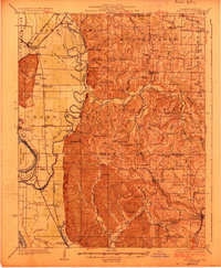
1924 Map of Alto Pass
USGS Topo · Published 1924About this map
The Mississippi River and its intricate network of bayous and ditches define this 1920s landscape along the Jackson and Union county line. The western bottomlands, marked by the Big Muddy River and Worthen Bayou, contrast sharply with the elevated terrain of the eastern ridges. This era shows a densely settled rural society where small community centers like Gorham and Grand Tower anchor a lattice of country schools such as Shoal Creek and Miller School.
Find a feature on this map
85 named features on this map. Tap any name to fly to it.
Don’t see what you’re looking for? This feature index may not catch every label — zoom into the map to look around manually.
Map Details
Editions of this 1924 Alto Pass Map
2 editions found

Other maps of this area

1910 · Herrin
USGS Topo · 1:62,500

1910 · Murphysboro
USGS Topo · 1:62,500

1916 · Campbell Hill
USGS Topo · 1:62,500

1918 · Altenburg
USGS Topo · 1:62,500

1918 · Campbell Hill
USGS Topo · 1:62,500

1920 · Jonesboro
USGS Topo · 1:62,500

1920 · Dongola
USGS Topo · 1:62,500

1922 · Carbondale
USGS Topo · 1:62,500

1922 · Cape Girardeau
USGS Topo · 1:62,500

1923 · Dongola
USGS Topo · 1:62,500