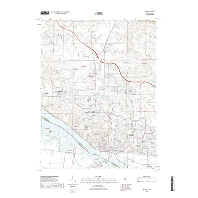
2018 Map of Alton
USGS Topo · Published 2018About this map
The Mississippi River creates a prominent boundary between Illinois and Missouri, anchoring the industrial and residential landscapes of Alton and East Alton. This 2018 survey detail shows the convergence of the river with the Clark Bridge, a critical crossing that links the Missouri side's West Alton and Dresser Island to the higher bluffs of Madison County. The map is notable for its concentration of memorial sites, including the North Alton Confederate Cemetery and the Lovejoy Memorial Cemetery, reflecting the area's deep ties to American history. Northward, the village of Godfrey hosts the Benjamin Godfrey Campus of the Lewis and Clark Community College. Residential development is interspersed with natural features like Hop Hollow and Youngblood Hollow, while recreational spaces such as the Alton-Woodriver Sportsmens Reservoir highlight the varied land use of this riverfront corridor.
Find a feature on this map
59 named features on this map. Tap any name to fly to it.
Don’t see what you’re looking for? This feature index may not catch every label — zoom into the map to look around manually.
Map Details
Editions of this 2018 Alton Map
This is the sole edition of this map. No revisions or reprints were ever made.
Other maps of this area

1925 · Brighton
USGS Topo · 1:62,500

1927 · Alton
USGS Topo · 1:62,500

1927 · St. Charles
USGS Topo · 1:62,500

1928 · Brighton
USGS Topo · 1:62,500

1930 · Jerseyville
USGS Topo · 1:62,500

1933 · Jerseyville
USGS Topo · 1:62,500

1933 · Saint Charles
USGS Topo · 1:62,500

1934 · Alton
USGS Topo · 1:62,500

1935 · Florissant
USGS Topo · 1:24,000

1935 · Columbia Bottom
USGS Topo · 1:24,000