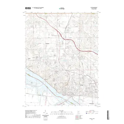
2021 Map of Alton
USGS Topo · Published 2021About this map
Alton sits at a critical bend in the Mississippi River, where the industrial and residential corridors of North Alton and Godfrey meet the limestone bluffs. This 2021 survey documents a landscape profoundly shaped by its position at the river's edge, including the prominent Clark Bridge connecting Illinois to West Alton and Dresser Island. The map is particularly valuable for genealogists, as it clearly identifies numerous historic burial grounds including the Confederate Cem, Oakwood Cem, and the Lovejoy Memorial Cem.
Find a feature on this map
86 named features on this map. Tap any name to fly to it.
Don’t see what you’re looking for? This feature index may not catch every label — zoom into the map to look around manually.
Map Details
Editions of this 2021 Alton Map
This is the sole edition of this map. No revisions or reprints were ever made.
Other maps of this area

1925 · Brighton
USGS Topo · 1:62,500

1927 · Alton
USGS Topo · 1:62,500

1927 · St. Charles
USGS Topo · 1:62,500

1928 · Brighton
USGS Topo · 1:62,500

1930 · Jerseyville
USGS Topo · 1:62,500

1933 · Jerseyville
USGS Topo · 1:62,500

1933 · Saint Charles
USGS Topo · 1:62,500

1934 · Alton
USGS Topo · 1:62,500

1935 · Florissant
USGS Topo · 1:24,000

1935 · Columbia Bottom
USGS Topo · 1:24,000