
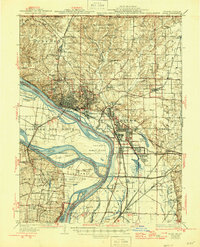
1934 Map of Alton
USGS Topo · Published 1934About this map
The confluence of the Mississippi River and the Missouri River dominates this landscape, where heavy industry and historic settlements meet the floodplains of St Ferdinand Bottom and Chouteau. The city of Alton stands as a significant rail and river hub, with the St Louis and Alton Electric Railroad and the Illinois Terminal Railroad tracing the shoreline. Further inland, the landscape is dotted with early 20th-century rural infrastructure, including the Monticello Seminary near Godfrey and the Alton State Hospital further east.
Find a feature on this map
99 named features on this map. Tap any name to fly to it.
Don’t see what you’re looking for? This feature index may not catch every label — zoom into the map to look around manually.
Map Details
Editions of this 1934 Alton Map
2 editions found
Other maps of this area

1888 · St. Louis
USGS Topo · 1:62,500

1907 · Belleville
USGS Topo · 1:62,500

1912 · Gillespie
USGS Topo · 1:62,500

1915 · Gillespie
USGS Topo · 1:62,500

1925 · Brighton
USGS Topo · 1:62,500

1927 · Alton
USGS Topo · 1:62,500

1927 · St. Charles
USGS Topo · 1:62,500

1927 · Edwardsville
USGS Topo · 1:62,500

1928 · Brighton
USGS Topo · 1:62,500

1930 · Jerseyville
USGS Topo · 1:62,500