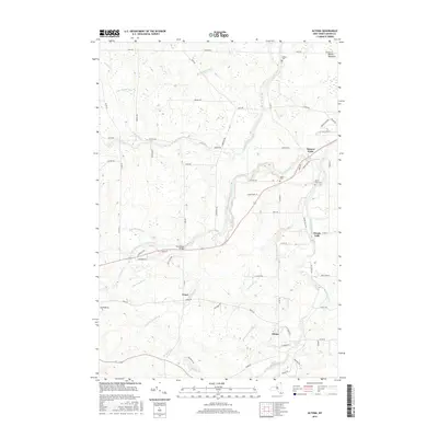
2016 Map of Altona
USGS Topo · Published 2016About this map
Mooers Forks and Altona anchor this corner of Clinton County, where the hydrography is defined by the North Branch Great Chazy River and its numerous tributaries. The landscape is a network of small settlements and rural homesteads connected by a grid of named roads like Davison Rd and Gero Rd. Historical markers such as Saint Anns Cem and Union Cem near the fork of the river suggest long-standing community roots.
Find a feature on this map
70 named features on this map. Tap any name to fly to it.
Don’t see what you’re looking for? This feature index may not catch every label — zoom into the map to look around manually.
Map Details
Editions of this 2016 Altona Map
This is the sole edition of this map. No revisions or reprints were ever made.
Other maps of this area

1895 · Mooers
USGS Topo · 1:62,500

1899 · Mooers
USGS Topo · 1:62,500

1915 · Churubusco
USGS Topo · 1:62,500

1942 · Mooers
USGS Topo · 1:62,500

1943 · Churubusco
USGS Topo · 1:62,500

1943 · Mooers
USGS Topo · 1:62,500

1950 · Lake Champlain
USGS Topo · 1:250,000
1956 · Mooers
USGS Topo · 1:62,500

1958 · Lake Champlain
USGS Topo · 1:250,000

1962 · Lake Champlain
USGS Topo · 1:250,000