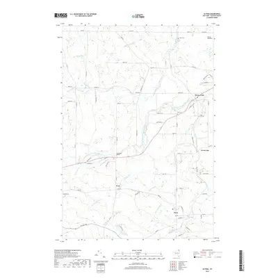
2019 Map of Altona
USGS Topo · Published 2019About this map
Mooers Forks and Altona serve as the primary hubs in this corner of Clinton County, where the network of the Great Chazy River and its numerous tributaries define the landscape. The hydrography is particularly complex here, with North Branch Great Chazy River and English River cutting through the terrain alongside smaller streams like Witherspoon Brook and Sample Brook. This drainage pattern historically influenced the placement of early settlements such as Irona and Woods Falls, which developed along these watercourses.
Find a feature on this map
72 named features on this map. Tap any name to fly to it.
Don’t see what you’re looking for? This feature index may not catch every label — zoom into the map to look around manually.
Map Details
Editions of this 2019 Altona Map
This is the sole edition of this map. No revisions or reprints were ever made.
Other maps of this area

1895 · Mooers
USGS Topo · 1:62,500

1899 · Mooers
USGS Topo · 1:62,500

1915 · Churubusco
USGS Topo · 1:62,500

1942 · Mooers
USGS Topo · 1:62,500

1943 · Churubusco
USGS Topo · 1:62,500

1943 · Mooers
USGS Topo · 1:62,500

1950 · Lake Champlain
USGS Topo · 1:250,000
1956 · Mooers
USGS Topo · 1:62,500

1958 · Lake Champlain
USGS Topo · 1:250,000

1962 · Lake Champlain
USGS Topo · 1:250,000