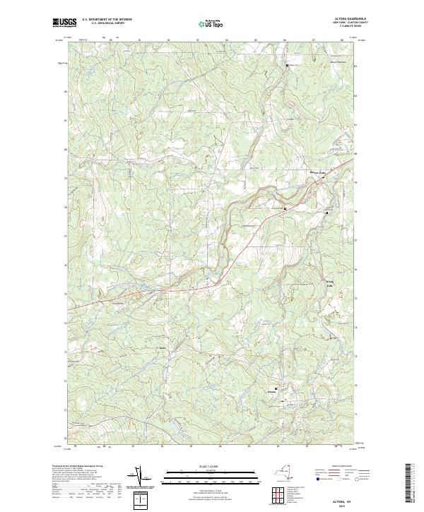
2023 Map of Altona
USGS Topo · Published 2023About this map
The Great Chazy River and its numerous tributaries, including the North Branch Great Chazy River and Witherspoon Brook, define the drainage and settlement patterns of this northern Clinton County landscape. The village of Altona sits near the southern edge of the map, while Mooers Forks and Woods Falls anchor the eastern reaches. The local infrastructure reveals layers of history, from the rural crossroads of Irona to the more modern military echoes found along Missile Base Rd.
Find a feature on this map
68 named features on this map. Tap any name to fly to it.
Don’t see what you’re looking for? This feature index may not catch every label — zoom into the map to look around manually.
Map Details
Editions of this 2023 Altona Map
This is the sole edition of this map. No revisions or reprints were ever made.
Other maps of this area

1895 · Mooers
USGS Topo · 1:62,500

1899 · Mooers
USGS Topo · 1:62,500

1915 · Churubusco
USGS Topo · 1:62,500

1942 · Mooers
USGS Topo · 1:62,500

1943 · Churubusco
USGS Topo · 1:62,500

1943 · Mooers
USGS Topo · 1:62,500

1950 · Lake Champlain
USGS Topo · 1:250,000
1956 · Mooers
USGS Topo · 1:62,500

1958 · Lake Champlain
USGS Topo · 1:250,000

1962 · Lake Champlain
USGS Topo · 1:250,000