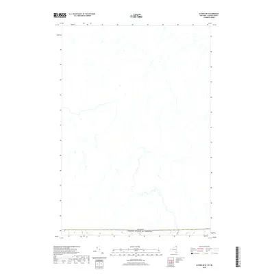
2019 Map of Altona OE N
USGS Topo · Published 2019About this map
The international border between the United States of America and Canada defines the southern edge of this map, reflecting the complex transborder landscape of northern Clinton County. Surveyed by the U.S. Geological Survey, the terrain is characterized by a dense network of local roads and waterways that cross the landscape in a predominantly north-south orientation. The lack of interior settlement labels emphasizes the rural, dispersed nature of this borderland region during the late twenty-teens. This map serves as a contemporary record of land use and hydrology just north of the border, where the Great North Woods meet the agricultural plains of the Saint Lawrence Valley.
Find a feature on this map
1 named feature on this map. Tap any name to fly to it.
Don’t see what you’re looking for? This feature index may not catch every label — zoom into the map to look around manually.
Map Details
Editions of this 2019 Altona OE N Map
This is the sole edition of this map. No revisions or reprints were ever made.
Other maps of this area

1895 · Mooers
USGS Topo · 1:62,500

1899 · Mooers
USGS Topo · 1:62,500

1915 · Churubusco
USGS Topo · 1:62,500

1942 · Mooers
USGS Topo · 1:62,500

1943 · Churubusco
USGS Topo · 1:62,500

1943 · Mooers
USGS Topo · 1:62,500

1950 · Lake Champlain
USGS Topo · 1:250,000
1956 · Mooers
USGS Topo · 1:62,500

1958 · Lake Champlain
USGS Topo · 1:250,000

1962 · Lake Champlain
USGS Topo · 1:250,000