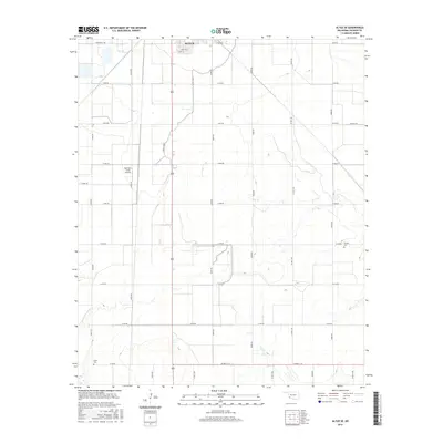
2016 Map of Altus SE
USGS Topo · Published 2016About this map
The Altus Canal cuts through the agrarian landscape south of Altus in Jackson County, showing the vital irrigation infrastructure of southwestern Oklahoma. This 2016 survey highlights a grid of section-line roads, such as Ridgecrest Rd and Co Rd E 173, that organize the vast agricultural fields characteristic of the region. Scattered throughout this rural network are points of significant interest for family historians, including Francis Cem and Elmer Cem, which serve as quiet landmarks of local heritage. The southern outskirts of Altus are visible near Mercury St and Libra St, while the Sheffield-Smith Airstrip illustrates the importance of private aviation in managing these expansive properties. This map effectively documents the intersection of modern municipal expansion and the enduring rural framework of the Oklahoma plains.
Find a feature on this map
30 named features on this map. Tap any name to fly to it.
Don’t see what you’re looking for? This feature index may not catch every label — zoom into the map to look around manually.
Map Details
Editions of this 2016 Altus SE Map
This is the sole edition of this map. No revisions or reprints were ever made.
Other maps of this area

1955 · Lawton
USGS Topo · 1:250,000

1958 · Frederick
USGS Topo · 1:62,500

1958 · Elmer
USGS Topo · 1:62,500

1963 · Altus SE
USGS Topo · 1:24,000

1964 · Martha
USGS Topo · 1:24,000

1964 · Altus
USGS Topo · 1:24,000

1964 · Tipton
USGS Topo · 1:24,000

1964 · Olustee
USGS Topo · 1:24,000

1964 · Headrick
USGS Topo · 1:24,000

1975 · Elmore City NE
USGS Topo · 1:24,000