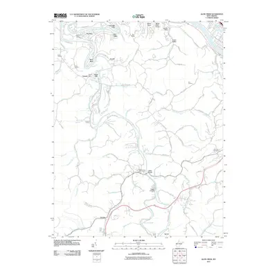
2011 Map of Alum Creek
USGS Topo · Published 2011About this map
The Coal River and its major forks dominate this West Virginia landscape, where the confluence of the Little Coal River and Big Coal River at Forks of Coal serves as a geographic centerpiece. This river system historically shaped the region's movement and industry, evidenced by the Csx Transportation line threading through the valley and the notable Sproul Tunnel. The settlement pattern is characterized by scattered communities such as Tornado, Riverlake, and Alum Creek, many tied to the winding riverbanks. Genealogists and local historians will find several family-named burial sites documented, including the Sutherland-White Cemetery, Henley Cemetery, and Templeton Cemetery. Natural river features like Upper Falls and Lower Falls remain prominent landmarks, while the Forks of Coal Memorial Park preserves the cultural heritage of this waterway junction.
Find a feature on this map
108 named features on this map. Tap any name to fly to it.
Don’t see what you’re looking for? This feature index may not catch every label — zoom into the map to look around manually.
Map Details
Editions of this 2011 Alum Creek Map
This is the sole edition of this map. No revisions or reprints were ever made.
Other maps of this area

1899 · Charleston
USGS Topo · 1:125,000

1909 · Charleston
USGS Topo · 1:62,500

1909 · Peytona
USGS Topo · 1:48,000

1909 · Saint Albans
USGS Topo · 1:62,500

1911 · Peytona
USGS Topo · 1:62,500

1911 · Madison
USGS Topo · 1:62,500

1929 · Madison
USGS Topo · 1:62,500

1929 · Peytona
USGS Topo · 1:62,500

1931 · Madison
USGS Topo · 1:62,500

1931 · Saint Albans
USGS Topo · 1:62,500