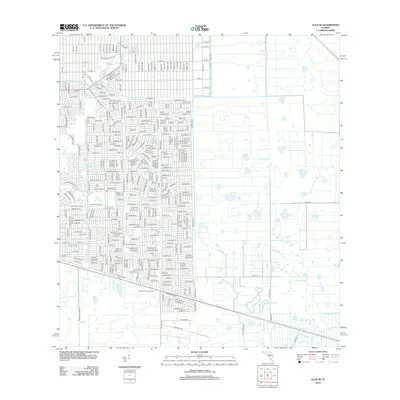
2012 Map of Alva SE
USGS Topo · Published 2012About this map
Corkscrew Lookout Tower stands as a focal point in this 2012 survey, overlooking a landscape defined by organized residential grids and intricate water management. The northwestern portion of the map shows a dense concentration of street developments, including Golfside Village Dr and a network of avenues such as Michael Ave and Gerald Ave. This suburban expansion is deeply integrated with the region's hydrology, where man-made features like the Able Canal and Townsend Canal regulate water flow across the low-lying terrain. To the southeast, the landscape transitions toward a more open character, marked by the natural drainage of Fussel Slough. The contrast between the rigid, named street blocks and the winding slough highlights the ongoing transformation of Florida's interior during the early 21st century as development pushed further into traditional rural and wetland areas.
Find a feature on this map
348 named features on this map. Tap any name to fly to it.
Don’t see what you’re looking for? This feature index may not catch every label — zoom into the map to look around manually.
Map Details
Editions of this 2012 Alva SE Map
This is the sole edition of this map. No revisions or reprints were ever made.
Other maps of this area

1956 · West Palm Beach
USGS Topo · 1:250,000

1957 · West Palm Beach
USGS Topo · 1:250,000

1958 · West Palm Beach
USGS Topo · 1:250,000

1958 · Corkscrew NW
USGS Topo · 1:24,000

1958 · Immokalee
USGS Topo · 1:24,000

1958 · Felda
USGS Topo · 1:24,000

1958 · Olga
USGS Topo · 1:24,000

1958 · Alva SW
USGS Topo · 1:24,000

1958 · Alva
USGS Topo · 1:24,000

1958 · Sears
USGS Topo · 1:24,000