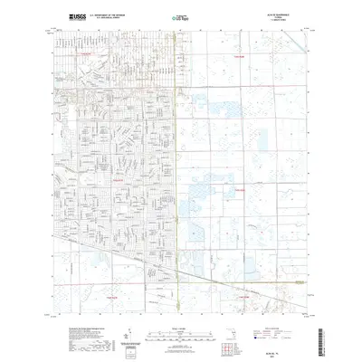
2021 Map of Alva SE
USGS Topo · Published 2021About this map
Leeland Heights serves as the primary residential hub on this survey, where a dense grid of streets like Lincoln Ave and Greenwood Ave meets the essential water management systems of Southwest Florida. The landscape is defined by its drainage infrastructure, including the prominent Able Canal and Townsend Canal, which underscore the region's managed hydrology. Local community anchors are visible in the northwest, specifically the Faith Lutheran Church and the adjacent Rose Garden Cemetery. Beyond the residential clusters, the terrain transitions into a mosaic of wetlands and sloughs, with Fussel Slough and Gator Slough Lane marking the natural drainage patterns that persist alongside 21st-century development. The intersection of three counties—Lee, Hendry, and Collier—occurs at the southern edge of this map, illustrating the administrative complexity of this inland territory.
Find a feature on this map
199 named features on this map. Tap any name to fly to it.
Don’t see what you’re looking for? This feature index may not catch every label — zoom into the map to look around manually.
Map Details
Editions of this 2021 Alva SE Map
This is the sole edition of this map. No revisions or reprints were ever made.
Other maps of this area

1956 · West Palm Beach
USGS Topo · 1:250,000

1957 · West Palm Beach
USGS Topo · 1:250,000

1958 · West Palm Beach
USGS Topo · 1:250,000

1958 · Corkscrew NW
USGS Topo · 1:24,000

1958 · Immokalee
USGS Topo · 1:24,000

1958 · Felda
USGS Topo · 1:24,000

1958 · Olga
USGS Topo · 1:24,000

1958 · Alva SW
USGS Topo · 1:24,000

1958 · Alva
USGS Topo · 1:24,000

1958 · Sears
USGS Topo · 1:24,000