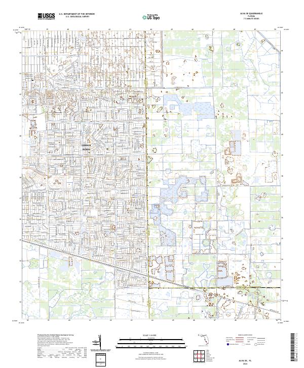
2024 Map of Alva SE
USGS Topo · Published 2024About this map
Lehigh Acres dominates the northwestern portion of this 2024 landscape, showcasing the dense, systematic grid of residential streets that defines this modern Florida community. The intricate network of local roads is punctuated by the Faith Lutheran Church Rose Garden Cem, a significant landmark for local history and genealogy. This residential development transitions into more open, aquatic terrain to the east and south, where the drainage infrastructure of the Able Canal and Townsend Canal manages the low-lying geography. The map also delineates the meeting of three major jurisdictions at the intersection of Lee, Hendry, and Collier counties. Along the southern edge, the course of Immokalee Rd provides a primary transit artery through the region, while the natural waterway of Fussel Slough winds through the wetlands in the southeast corner.
Find a feature on this map
10 named features on this map. Tap any name to fly to it.
Don’t see what you’re looking for? This feature index may not catch every label — zoom into the map to look around manually.
Map Details
Editions of this 2024 Alva SE Map
This is the sole edition of this map. No revisions or reprints were ever made.
Other maps of this area

1956 · West Palm Beach
USGS Topo · 1:250,000

1957 · West Palm Beach
USGS Topo · 1:250,000

1958 · West Palm Beach
USGS Topo · 1:250,000

1958 · Corkscrew NW
USGS Topo · 1:24,000

1958 · Immokalee
USGS Topo · 1:24,000

1958 · Felda
USGS Topo · 1:24,000

1958 · Olga
USGS Topo · 1:24,000

1958 · Alva SW
USGS Topo · 1:24,000

1958 · Alva
USGS Topo · 1:24,000

1958 · Sears
USGS Topo · 1:24,000