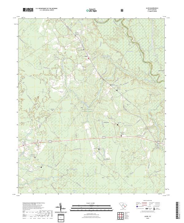
2024 Map of Alvin
USGS Topo · Published 2024About this map
Alvin serves as the central hub of this Berkeley County landscape, positioned along the historic route of Santee River Rd. The area is defined by its deep spiritual and community roots, evidenced by an exceptional concentration of rural sanctuaries such as Bethlehem Church, Holly Hill Church, and Macedonia Church. Many of these sites include long-standing burial grounds like the Macedonia Church Graveyard and Hoods Chapel Church Graveyard, while family-named sites like Taylor Cem and Edens Eagerton Cem mark the heritage of local landowners.
Find a feature on this map
74 named features on this map. Tap any name to fly to it.
Don’t see what you’re looking for? This feature index may not catch every label — zoom into the map to look around manually.
Map Details
Editions of this 2024 Alvin Map
This is the sole edition of this map. No revisions or reprints were ever made.
Other maps of this area

1919 · Cordesville
USGS Topo · 1:48,000

1943 · Shulerville
USGS Topo · 1:24,000

1943 · Trio
USGS Topo · 1:24,000

1943 · Jamestown
USGS Topo · 1:24,000

1943 · Bonneau
USGS Topo · 1:62,500

1948 · Cordesville
USGS Topo · 1:24,000

1948 · Bethera
USGS Topo · 1:24,000
1949 · Cordesville
USGS Topo · 1:24,000

1949 · Georgetown
USGS Topo · 1:250,000
1950 · Bethera
USGS Topo · 1:24,000