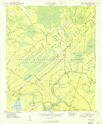
1950 Map of Bethera
USGS Topo · Published 1950About this map
Bethera and Witherbee anchor this mid-century survey of the South Carolina Lowcountry, where the landscape is defined by the transition from upland forest to extensive wetland basins. Much of the terrain is occupied by the Francis Marion National Forest and the Santee Experimental Forest, revealing a complex system of "bays" and swamps like Little Hellhole Bay and Walleye Bay. The Seaboard Air Line railroad bisects the quadrangle, serving local timber and agricultural interests through stops such as Herberta Siding.
Find a feature on this map
68 named features on this map. Tap any name to fly to it.
Don’t see what you’re looking for? This feature index may not catch every label — zoom into the map to look around manually.
Map Details
Editions of this 1950 Bethera Map
2 editions found
Other maps of this area

1919 · Cordesville
USGS Topo · 1:48,000

1943 · Shulerville
USGS Topo · 1:24,000

1943 · Jamestown
USGS Topo · 1:24,000

1943 · Ocean Bay
USGS Topo · 1:24,000

1943 · Bonneau
USGS Topo · 1:62,500

1948 · Cordesville
USGS Topo · 1:24,000

1948 · Bethera
USGS Topo · 1:24,000
1949 · Cordesville
USGS Topo · 1:24,000

1949 · Georgetown
USGS Topo · 1:250,000
1950 · Huger
USGS Topo · 1:24,000